
Digital Marketing
Consultant.
I am Sudhir Gattawar, a Digital Marketing Professional for over 20 years. I assist companies/ brands target their B2B, B2C and D2C audiences in digital world to generate high-quality business leads to increase sales conversion. Connect with me to understand available and your market share in the online space. Get best of Organic & Paid traffic.


Everything you need to know about me
I am a traveller, a photographer, a Yoga practitioner and a tutor. But that is what I do in my time as a hobby. But career wise, I have dedicated my passion to Digital Marketing. It is my profession.
With over 20 years of rich multi-industry experience in Digital Marketing, I have planned, executed, monitored and delivered numerous digital marketing projects to help companies achieve their business goals. During my professional journey, I have been honoured to work with many creative teams, business units, project managers and senior leaders across geographies to implement digital marketing strategies on multiple platforms.
I am here to assist you drive quality leads and increase sales performance, thereby assisting in revenue growth. I do deep analysis to find available market for your business online and your share of voice. Based on the research data I improve website on a technical parameters, content, presentation & then plan Inbound marketing campaigns across organic and paid channels that help grow the sales pipeline and improve conversion rate.
Hire a Digital Marketing Consultant for Your Business
Everything I do, I do it for you.
I hope Bryan Adams won't mind me borrowing this one! ;-)
When it comes to business, every action must yield a result. Especially if you put your money into it! As a Digital Marketing Consultant, I am driven to help you reach your goals. I look for ways to achieve the best ROIs in the quickest possible time with minimal effort.
Whether you have an in-house marketing team or are just starting to look for an inbound and content marketing consultant, I can help you accelerate growth, reach newer markets and generate more sales with results-oriented digital marketing campaigns. As an inbound marketing consultant, I can be an extension of your team to create and optimize your marketing and sales funnels.
- Accelerate your company’s revenue
- Reach new markets quickly
- Acquire new customers fast
- Improve lead quality
- Automate lead generation
- Reduce lead closing time
- Analyse lost leads and improve strategy
I know how to connect well with your target audience, connect to know more!
I have a knack for taking brands from concept to reality and getting the desired results in a very short duration. I have worked with local and international brands, startups and MNCs. I have worked at a digital agency and been a client too! Hence, understanding market dynamics, varied industries and project management come naturally to me. I am fully aware of the functioning of B2B, B2C & D2C business models across diverse types of customer personas. This allows me to think logically and effectively about marketing planning. I will be an asset to the organisation, paving a digital path to your brand's success and interaction with its audience.
Get max out of your budget, no budget is low, believe me!
Hire a pro at half the cost, means more saving
Hire an experienced digital marketing consultant working for you at a much lower cost than a full-time employee.
Flexibility in budget, means more saving
A strong background in digital marketing allows me to provide solid strategies for any budget. You can start with a small budget and increase when it is required.
Conversion matters the most, means more business!
Planning and execution are always focused on business growth, lead generation and conversion. Trust me, when I say that results matter most and you will see it for yourself.
Short-term ready to go plan, get result instantly
The short-term plan is to deliver results within the first 1-3 months. It is perfect for those who want to see fast results and build a simultaneous long-term strategy. Thus creating interesting talk points in your sales pitch or corporate communication. Creating various sales funnel and backed them with programmatic AD campaigns.
Long-term and study growth & a brand recall value
The ultimate goal of long-term tactics is to become an authority in the eyes of your target audience and build a community around your brand. The growing trust in your brand will establish your organisation and its employees as thought leaders in the industry amongst your peers, competition and customers. I plan to improve your brand awareness and generate leads from organic traffic.
Will help avoid costly missteps and save money
As a brand takes on a bigger role in the marketplace, there are chances of costly missteps. This leads to unnecessary expenses that could impact the brand negatively. Each step will be carefully monitored by me to devise a customized strategy & implement tactics that are designed to drive results. I will avoid non-performing activities to save costs.
My Approach - your success, here how it will work.
I'll help you develop the confidence to strategically look for opportunities that are right for you, having a vision of what will take place before it does so. I'd like to help you create a clearly defined plan of action that includes specific goals, solutions and timelines so we can work together towards your desired outcome (s).

Understanding business goals and help achieve them digitally.
Business goals can be a challenge to understand by the agencies and achieving them even more so. I work as your partner to understand goals in details and also to ensure that they are measurable and repeatable. You get step by step detailed plan to achieve your goals along with regular monitoring of progress on monthly, quarterly and annually basis.

Defining customer persona on the digital platforms, every platform is different.
A digital customer persona is an individualized representation of a product’s appropriate target audience, according to their characteristics, preferences, and behavioral traits. I will work with you closely to defining digital customer persona and create a detailed description for every type of user who might interact with your brand’s online properties.

Defining short-term and long-term goals.
Short-term goals are those that we together can accomplish within a few weeks or months. Long-term goals are more ambitious and require more time to complete. You will get detailed plan to achieve them and reports periodically.
Finding right digital medium for your business, save time and money.
There is an old saying, “If you build it, they will come.” This statement is not true in today’s time. You need to leverage various digital platforms. You need to be where your customers are and where they want to be if you are going to be successful in this arena of business. I will assist you to find the right ones, so you can get started on the path to achieving your goals and being successful.

Crafting Digital Marketing Strategy. Rightly planned and well executed.
Your product We help needs customised digital marketing strategies according to your business needs. I aim to give brand recognition and adequate visibility with the help of different online platforms. At the end you want to stand out in an increasingly crowded digital space and get your share from the digital space.
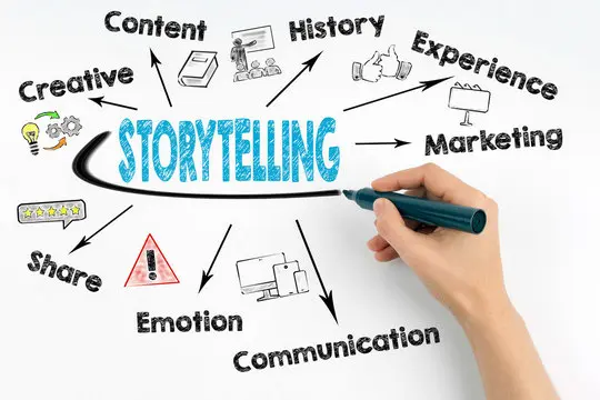
Content planning & Storytelling.
Connect, grab, convert.
Stories sell. Stories connect. Stories work. The right story can be a key to success. I’ll help finding the right words and phrases, choose the content that can create a story which matches your product, target audience and your brand identity properly.

Hiring in-house team or an agency to execute the task? Let's discuss!
Do you have question in your mind whether to hire in-house team or an agency? If yes then don't worry I'll help you suggest what is right for your business.

Monitoring and measure your success, keep improving, keep going!
As a digital marketing consultant, one of my key responsibilities is to monitor and measure your digital marketing initiatives. It is important to do this so that you can be confident that all of your marketing efforts are aligned with your goals and most importantly producing the desired results. You will receive reports periodically and corrective suggestions from my side if I see any room for improvement in your campaign.
Marketing Consultant vs External digital agency vs In-house Marketers
The benefits of working with independent marketing consultants are diverse. Independent marketing consultants generally offer higher levels of expertise, creativity, and flexibility than agencies or in-house staff. They also have less bureaucratic restraints on the campaign teams they can assemble, so they can often move faster to implement ideas. Moreover, you can get it at 50% less cost than having a full-time employee on your team.
Hiring a marketing consultant to lead your inbound and content marketing strategy is not only cost-effective, but it can also provide valuable insights into your business not found through any other means. There is no better option than to hire an independent inbound marketing consultant – they are more experienced, they will help you avoid missed opportunities and potential issues, they become trusted advisors that help train the rest of your team.
They Say
Sushil Matey
CEO - The Indian Society of Advertisers (ISA)
" He has an eye for the details and knows his job inside and out. He will work hard to get things done exactly as you would want them, he pays attention to every detail."
Ketan Trivedi
Founder - Ever Aspire Consulting
" With his deep understanding of online media, he helped my brand gain visibility and connect with my audience – this helped me save money & time spent on ineffective strategies"